Braille Drawing: Africa
Size: 19 rows, 29 cells
By: René Holzhauer (2022)
Here we go!
Row 1:
space 5 times, IN, hyphen, IN, colon, c 3 times, semicolon
Row 2:
space 3 times, capital sign, i, space 7 times, e, colon, apostrophe, space, IN, EN, hyphen 3 times
Row 3:
space 2 times, capital sign, AR, space 10 times, dot 4, c, space 4 times, l
Row 4:
space, dots 56, a, space 18 times, dots 456
Row 5:
dots 56, a, space 20 times, WH
Row 6:
space, l, space 21 times, GH
Row 7:
dot 4, semicolon, space 22 times, e, apostrophe
Row 8:
space, dot 4, EN, space 22 times, dot 4, colon, c, n
Row 9:
space 3 times, e, hyphen, IN, colon 2 times, hyphen, apostrophe, space 15 times, ST
Row 10:
space 11 times, dots 456, space 13 times, IN, a
Row 11:
space 11 times, dot 4, apostrophe, space 11 times, ST
Row 12:
space 12 times, dot 4, semicolon, space 9 times, dots 456
Row 13:
space 13 times, WH, space 9 times, dot 4, semicolon
Row 14:
space 12 times, dots 56, a, space 10 times, l, space, hyphen, i, l
Row 15:
space 12 times, dots 45, apostrophe, space 8 times, IN, c, space, dots 456, space, dots 456
Row 16:
space 13 times, dots 456, space 8 times, l, space 2 times, dots 456, l
Row 17:
space 14 times, space 6 times, s, space 4 times, c
Row 18:
space 14 times, dots 45, apostrophe, space 4 times, s
Row 19:
space 15 times, GH, hyphen, colon 2 times, a
Description of the Drawing
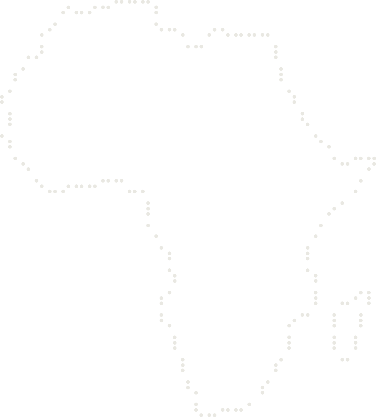
Translated by AI: This braille drawing shows an outline map of the African continent. The island of Madagascar (which belongs to the East Africa region) is also shown to the south-east of Africa. For a comparison of size: Madagascar is about 1.6 times the size of Germany. The African continent is crossed by the equator. To find it in the Braille map, you can draw an imaginary line between points 1 and 4 on row 11.
The Mercator projection was used to create this outline map. You can find more information about this type of projection on the Wikipedia page: https://de.wikipedia.org/wiki/Mercator-Projektion